The Capital

06.2016

In 1997 the capital of Kazakhstan was moved from the historic city of Almaty, which had served as the seat of government throughout the years as a republic within the Soviet Union. Previously called Akmoly (along with various versions of that name) and Tselinograd, the new capital was renamed Astana, meaning “the Capital.” Based on a masterplan by Kisho Kurokawa, the small city was largely reoriented to focus towards the new grand governmental axis on the West bank of the Ishim River. With the completion of next year’s Expo 2017, the city will densify further to the Southwest, placing the monumental axis closer to the center of the urbanization.

Astana is the only city in this study which is still overwhelmingly a work in progress.

Above: the Bayterek Monument

a0_1

the GasMunayKaz


City of Icons

06.2016

Astana is built in the steppe, which means an excess of space is also provided around the buildings of the new city. The buildings are often treated as unique objects independent of context. This creates an environment where the imagery of buildings is supremely important.

In this respect they tend towards either postmodern nostalgia, Eurasian neoclassicism, or postmodern- futuristic iconography, usually existing side by side. Nevertheless, many of these projects appear to be conventional concrete construction with curtainwall or rainscreen facades.

The three projects in Astana by Norman Foster are notable exceptions to this conventional trabeated structure, although they do indicate the need for symbolism and iconography in the city. They are notable too, because their urbanistic importance (anchoring the main axis of the city from either end) provides them even more extensive landscaping. This allows earthen berms to lift their masses and provide entry from below, further maintaining their pure geometries without the architectural “distractions” of entrances and canopies.

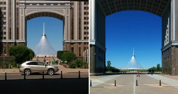
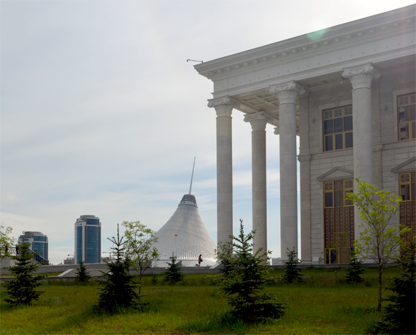
Above: the Khan Shatyr center with the Astana Opera in the foreground

a1_1

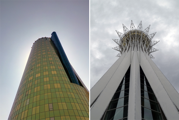
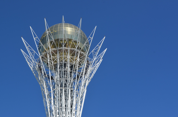
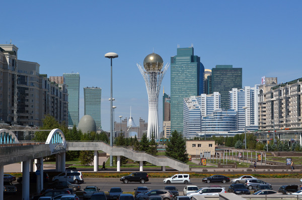
A tower of the House of Ministries complex | The iconic Bayterek Monument

a1_2

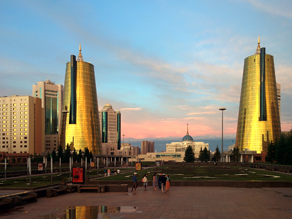
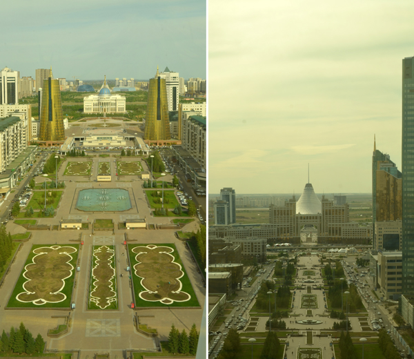
A view down the park of Nurzhol Boulevard towards the Presidential Palace

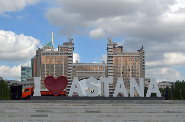
The nomenclature of the country also lends itself to objectifying architecture. Astana means “the Capital”, their currency Tenge means “money.” Various buildings carry nicknames: the iceberg, the sweet corn, the cigarette lighter[1], the pyramid. Which came first, the pithy title or the architectural project?

Symbolism of course is always present in governmental architecture, whether with regards to massing, ornamentation, material, etc. Given the relatively contemporaneous construction of the entire new city center, in Astana the question can be asked what meaning is given to style and architectural language: what is it about the president’s house or the supreme court building that requires a classical colonnaded facade, while the ministry building receives two golden rocket ships? But it is also a question of content: what makes the Khan Shatyr mall and the Palace of Peace and Reconciliation, both by Norman Foster, so iconographic, and so formally similar? When everything is given meaning, can there be any content?

a1_3

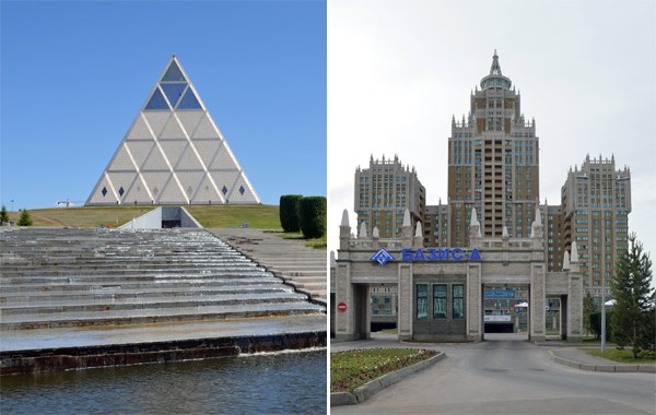
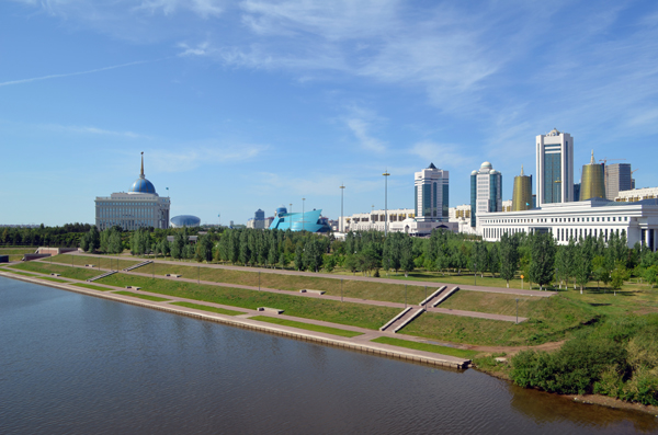
Foster’s Palace of Peace and Reconciliation | the “Triumph of Astana” building from 2006

1. Meuser, Philip. Architectural Guide Astana


Axial City

06.2016

At the western extreme of the grand axis of Nurzhol Boulevard lies Norman Foster’s Khan Shatyr shopping center, a tent of ETFE which captures solar energy to maintain the interior at a comfortable temperature during the winter. With parking and loading entries around the back, it seems unlikely that the axis can continue beyond this building. Across the Ishim at the eastern cap of the axis another of Foster’s major buildings in Astana, the Palace of Peace and Reconciliation followed by the Kasak Eli Independence Monument, and further out more undeveloped land.

Only three structures cross the axis between these anchors: the KazMunayGas Headquarters, the Bayterek Monument, and the Presidential Palace. An overlapping system of roadways and pedestrian over/underpasses links the Khan Shatyr and the plaza in front of the presidential residence. The axis is traversed on foot relatively easily from the shopping center, until the interruption of the palace and Ishim river.

Above: Views from the Bayterek Monument along the axis both East and West

a2_4

The axis is interrupted by the Ishim River

a2_3

View from the Central Concert Hall. From left, the House of Ministries, the towers of the Government House, Mazhilis, and Senate, and the Supreme Court

The symbolism of the city plan is extremely powerful, with the strong central axis and the avian geometry of the park surrounding the Palace of Peace[1]. Yet, the programmatic distribution does not necessarily strengthen the hypothesis that the governmental power structure is reflected in the urban configuration (How does the shopping mall at the head of the new city, compare to the pyramid celebrating cooperation between religions?) Rather than being planned as a modernist city with separate zones of offices, government, residential and industry, many of these programs are mixed in their adjacencies along the major axis.

Yet this seemingly random organization hints that in the post-Soviet autocracy all these sectors are interrelated. The Ministry of Transport and Communications, the President’s party headquarters, and various luxury residential towers are all along this axis. The KazMunayGas serves as a gateway to the Khan Satyr, while in contrast the Supreme Court is (by local standards) a relatively modest post-modern building tucked away on the governmental plaza. The placement of each of these buildings is either a result of fortune, or a highly calculated and symbolic expression of their relative importance with respect to the center of power.

a2_5

a2_1

Approach towards the Khan Shatyr viewed through the KazMunayGas arch.

1. Chandigarh for example is gridded, and its major governmental buildings are grouped in a campus rather than along a major triumphal axis. In fact, Le Corbusier intended to use ground formations to obscure the view of the buildings from the main access road.